


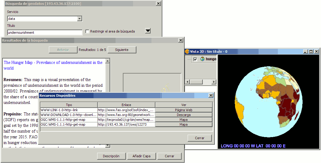
This tool appears when the 3D view is activated. It works the same way as in the 2D view, allowing search by keyword, displaying a panel with the results and allowing the user add the layer if it is defined in the catalogue. The following figure summarizes the steps taken to add a remote WMS layer from the list of FAO.
Similarly you can add layers WCS and WFS, to which the coordinate system of the layer will be assigned, as long it is supported by the service. Note that on adding a layer WFS, the user will be prompted whether or not to rasterize the layer, as occurs when adding any vector layer.
Added improvement in the 3D plugin is that when you press the button to add a WMS service as a layer from catalogue search, it will open the properties window of the remote service WMS, which will allow you to select properties such as style, format and reference coordinate system. This last step is important so that the layer will display properly in 3D.


